Point Cloud to CAD Conversion
Point Cloud to CAD services convert laser-scanned data or LiDAR of building sites into editable DWG or DXF formats. 3D Scan to CAD promotes the development of precise as-built drawings and enables superior decision-making for renovation projects.
Understanding 3d Scan to CAD Conversion
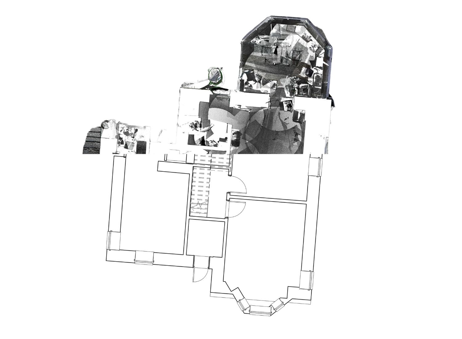
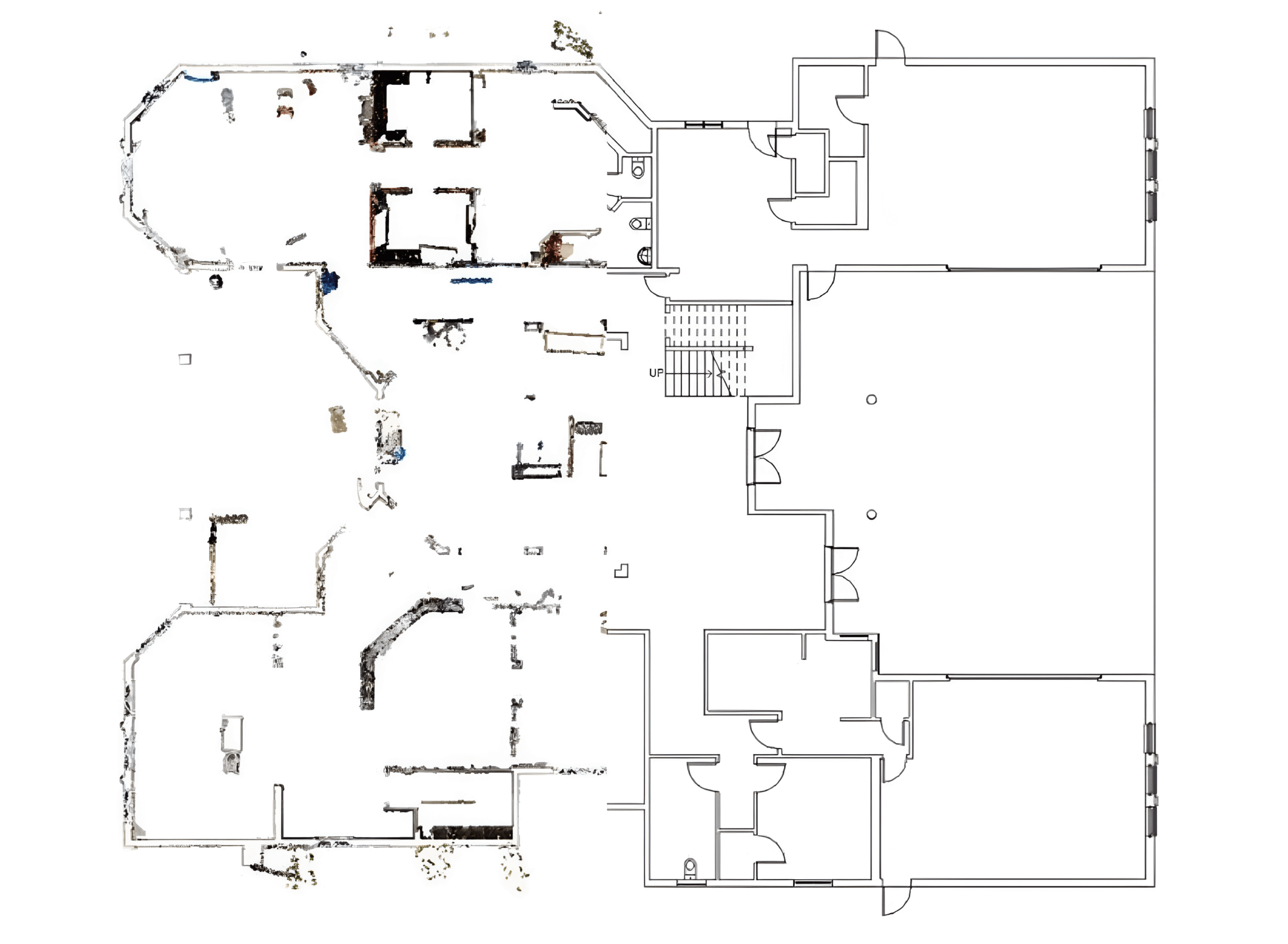
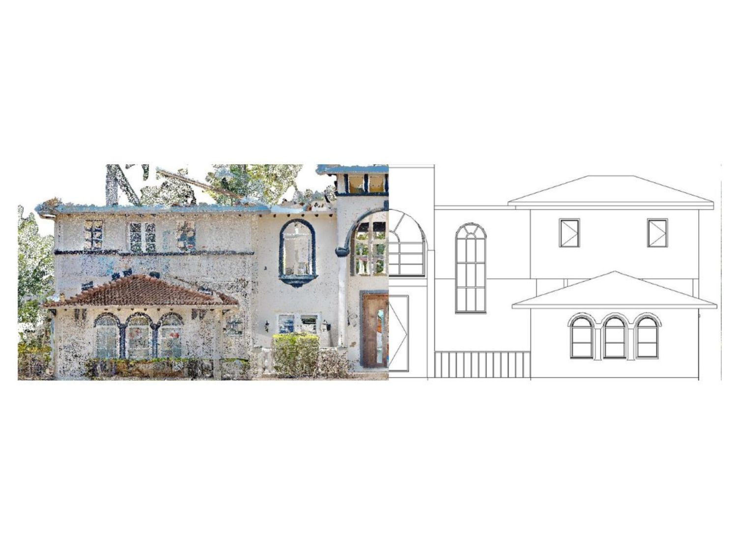
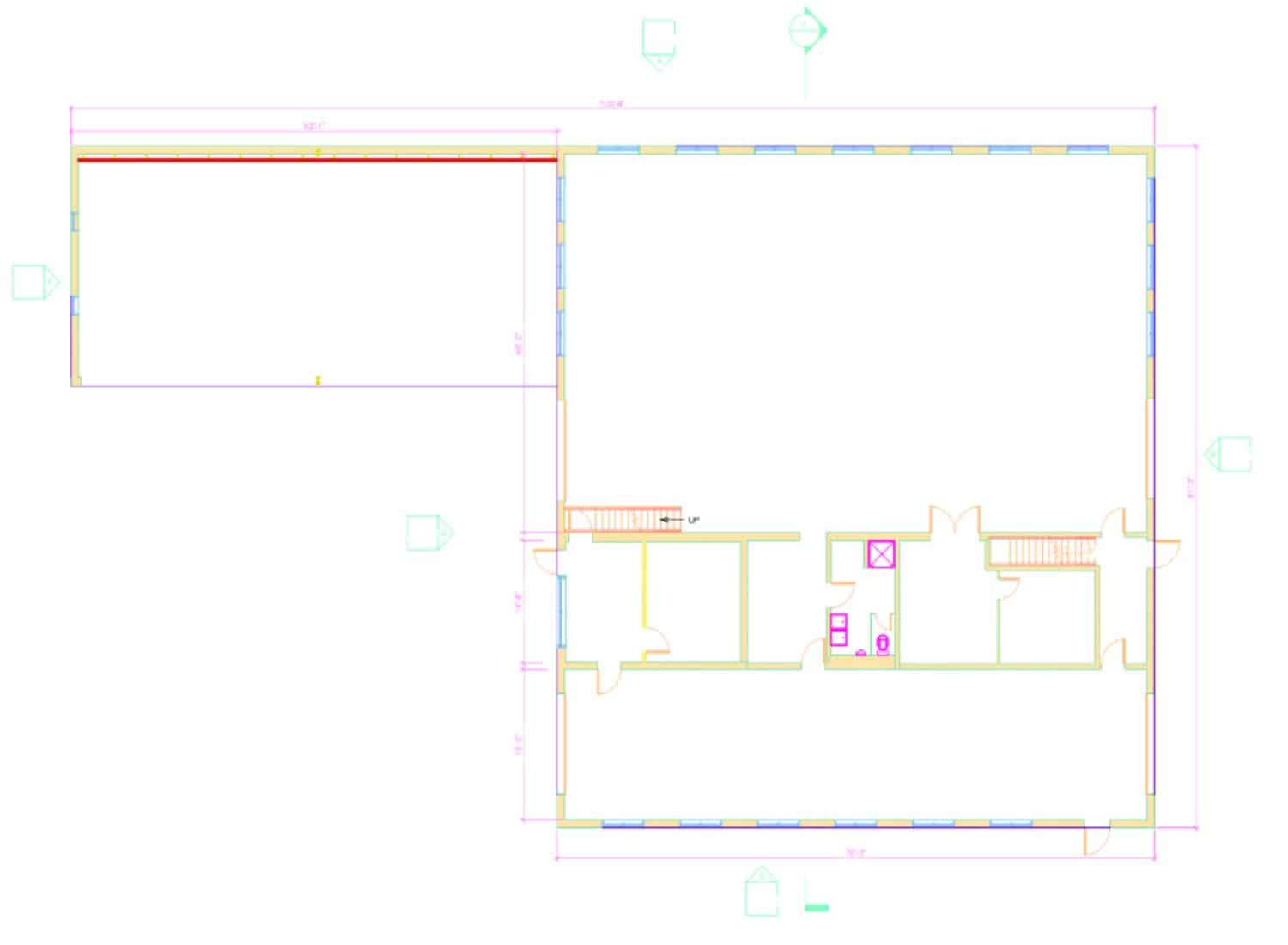
3D Scan to CAD conversion involves converting point cloud laser scanned data (RCP, E57, LAS) into 2D CAD drawings. The common formats of CAD drawings include DWG and DXF. This process enables surveying and AEC professionals to capture existing building conditions using advanced laser scanners such as Faro, Leicia etc.. The goal of 3D Scan to CAD is to develop editable floor plans, sections, elevation in DWG or DXF formats for architectural, structural, or MEP disciplines. Point cloud to dwg conversion improves renovation planning, ensures compliance with as-built conditions, and supports facility management. The common uses of 3D Scan to CAD conversion include renovation projects, heritage preservation, retrofit projects, and industrial plant as built drawings.
We have transformed ourselves as a team over the years to become a trusted supplier for point cloud to CAD services. Whether it is a residential project, amphitheater, or a high-rise building with 20 floors, we have assisted AEC and surveying professionals with developing Architectural & Engineering DWG drawings by following their drafting standards in the USA, UK, Europe, and Australia. We are well-versed with Autodesk software such as Recap Pro, Revit, and AutoCAD, making sure that our deliverables meet the core requirements of our clients, which typically include renovation, site inspections, and facilities management.

Scan to AutoCAD - Point Cloud to DWG Conversion
Our Result Drive Point Cloud to CAD Conversion Services
We convert point cloud data into accurate 2D CAD drawings using Autodesk tools. Supporting formats like RCP, E57, and LIDAR, we capture architectural, structural, and MEP details based on your required LOD.
Scan to CAD Conversion Services for Renovation
- Editable Architectural Drawings from Point Cloud Data
- Detailed Structural Drawings from Laser Scanned Data
- Fire Fighting Drawings from Point Cloud for Planning
Point Cloud to CAD Conversion for Facilities Management
- Point Cloud to MEP Drawings for effective Asset Management
- 3D Scan to As built Architectural Drawings for Lifecycle Management
- Tagging and Annotation as Extracted from Matterport 3D Scans
3D Laser Scan to DWG Drawings for Construction Verification
- DWG design drawings from 3D scans to avoid onsite conflicts
- Architectural CAD drawings from point clouds for maintenance
-
Scan to CAD drawings as a foundation for developing BIM models for clash detection .
Why Choose Cresire for 3D Scan to CAD Services?
Cross-Functional AEC Solutions
We offer multidisciplinary Point Cloud to CAD conversion services. Whether you need detailed drafting for Architectural, Structural, or MEP designs from point cloud data, we’ve got you covered.
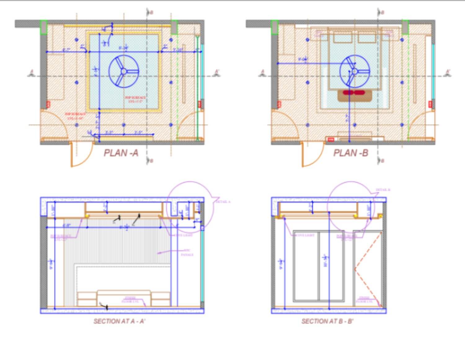
Detailed Focused Drafting: We offer flexible
detailing in AutoCAD drawings generated from point cloud laser scans. Our services include generic floor plans, detailed floor plans, and as-built plans with sections and elevations
Capability of working with multiple scans
We accept registered point cloud data in multiple different formats including RCP, E57, LAS, PTS, XYZ etc.
Precision is our Priority
We conduct an analysis of the point cloud data and provide you with detailed feedback. Based on the required Level of Detail (LOD) for Point Cloud to CAD conversion, we assess whether the data contains the necessary information
Smooth Scan to CAD Conversion Experience
Laser Scan to AutoCAD Requirement
To ensure accurate Scan to CAD output, we request that clients specify the scope clearly, their desired level of detail (LOD) for architectural or MEP drawings, and their preferred project timeline.
Pointcloud Data
For accurate Scan to CAD modeling, provide high-quality point cloud data (RCP, E57, LiDAR, PTS, LGS) and relevant AEC drawings to ensure precise and efficient CAD conversion.
Milestones and Timeline
We establish clear timelines and deadlines for Point Cloud to CAD deliverables to align with our production schedule and project milestones. If encourage our clients to communicate their expected timeline for a project.
Specification for Scan to CAD
To ensure our Scan to CAD drawings meet your expectations, please share technical requirements like CAD software preferences, file formats, drawing standards, or layering conventions in advance.
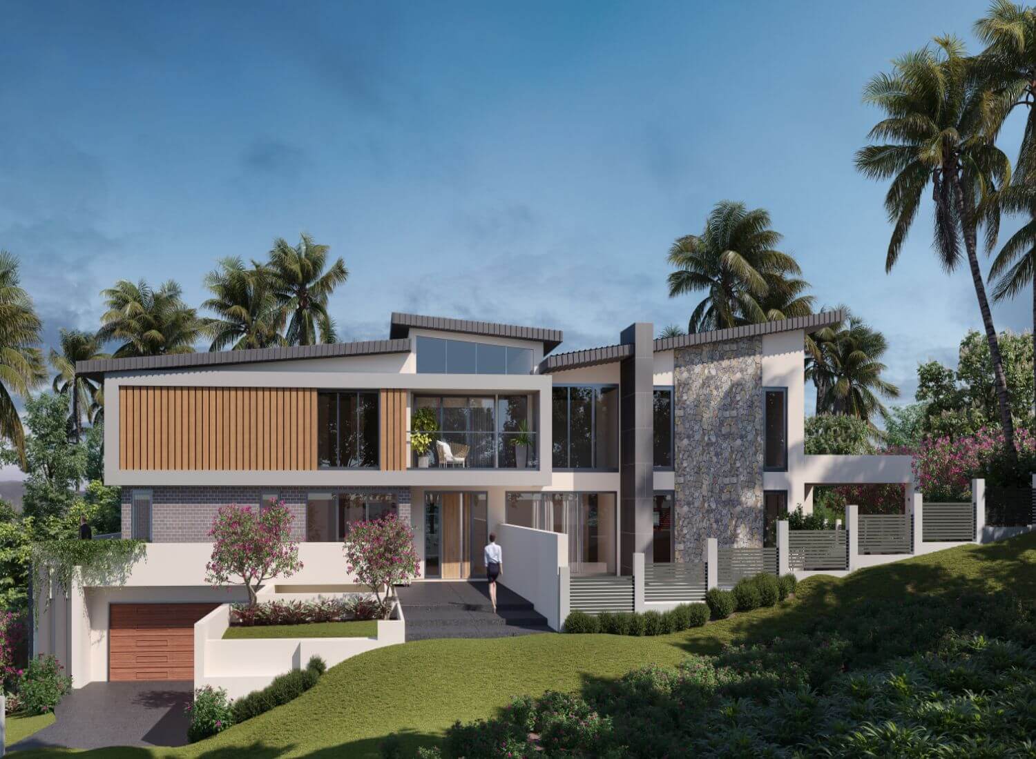
Our Recent Projects
We’re the pioneers in the industry with a comprehensive suite of services, innovative solutions & unmatched support.
Features of our 3D Scan to CAD Services
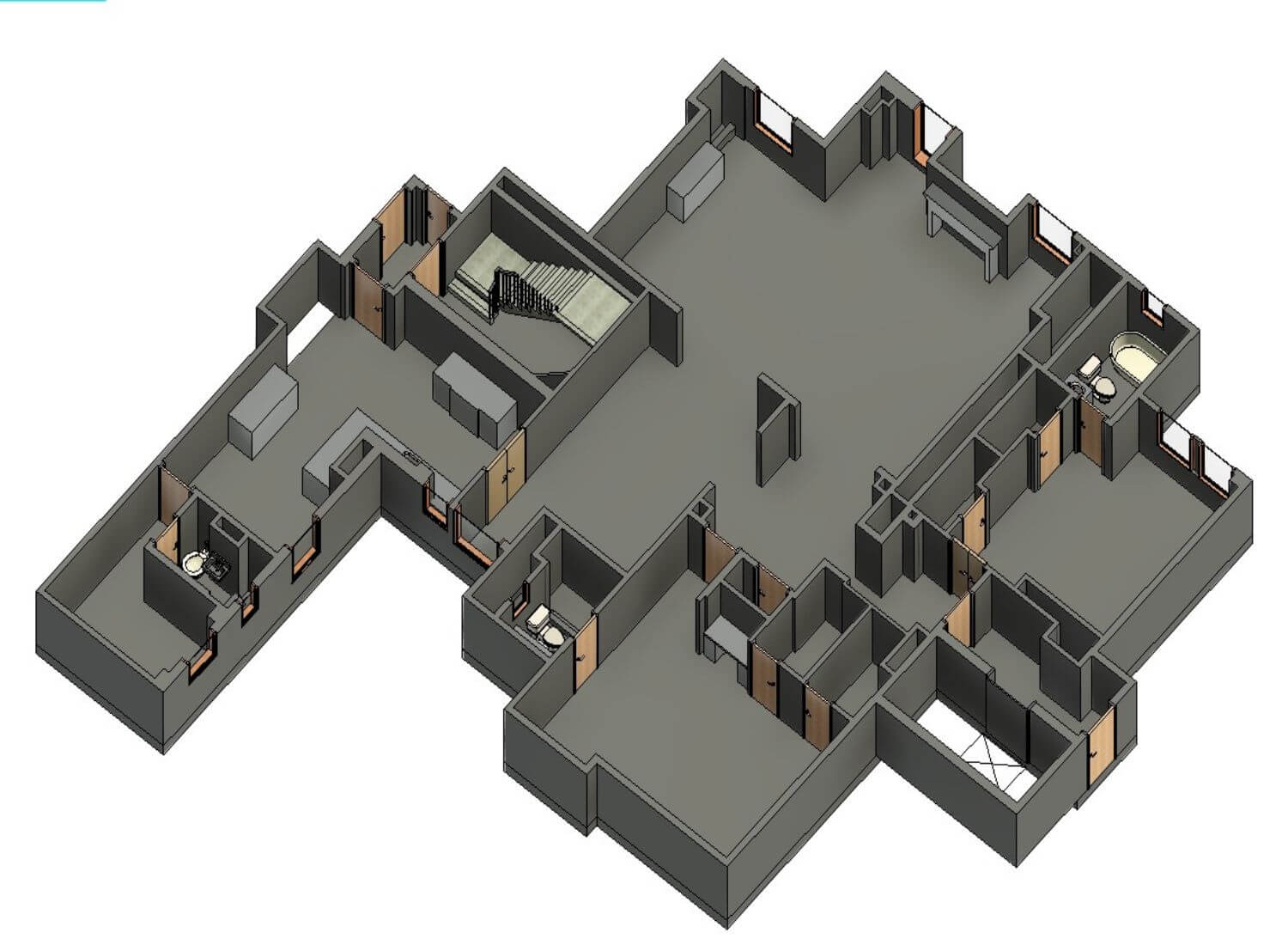
Accurate CAD Drawings from Point Cloud Scans
We convert point cloud data (E57, RCP, LAS, etc.) into accurate 2D floor plans, sections, and elevations across Architectural, Structural, and MEP disciplines.
Scan to Complex DWG Conversion
We review and work with the complex architectural/engineering laser scans with for developing editable AutoCAD drawings for your use.
Savings Through Strategic 3D Scan to CAD Collaboration
Leveraging our competitive production rates for the USA, UK, Europe, and Australia markets, we help our clients save time and costs by eliminating the costs for resource training and software investments.
Minimized Site Re-visits for Manual Measurements
We simply request good quality point cloud data, based on which we provide accurate AutoCAD floor plans, sections, and elevations. Hence, minimizing site visits and the obsolete manual process of measurement.
Insightful Point Cloud to 2D Drawing
Turn point cloud data into detailed 2D drawings that uncover spatial insights, helping architects and engineers make informed design, renovation, and construction decisions with confidence.
LiDAR Scan to CAD As-Builts
Transform LiDAR scans into precise CAD as-builts that clearly document existing site conditions, supporting accurate planning, design, and construction decisions with minimal guesswork.
FAQs
What are the benefits of scan to CAD?
The benefits of Scan to CAD include reducing time and effort spent on manual surveying and obtaining editable AutoCAD drawings for renovation, facilities management, and verifying existing complex site details with digital precision
What software do we use for the conversion?
We use AutoDesk Recap Pro, Revit and AutoCAD for point cloud to cad conversion
How accurate is the CAD output from scan data?
With high-resolution laser scanning and expert modeling, Scan to CAD can achieve millimeter-level accuracy, depending on the equipment and project needs.
Can point cloud data from any scanner be used for CAD conversion?
Yes, most professional services accept point cloud formats like .LAS, .E57, .RCS, and .PTS from common scanners such as Leica, Faro, and Trimble.
Is Scan to CAD Conversion useful in industrial facilities?
Yes, it's vital in documenting MEP layouts, machinery placement, and structural details for manufacturing plants and industrial environments.
What industries do we serve?
We serve professionals from a wide range of industries including surveying, architecture, civil engineering, mechanical, plumbing, facilities management, construction, building, amphitheater etc.
Why is Scan to CAD important for architecture and engineering projects?
It provides precise as-built data, reducing errors, saving time on manual measurements, and improving collaboration among architects, engineers, and construction professionals.