Superior Renovation Planning
Cost Effective Pricing
Eliminates Rework and Design Errors
Improved Facility Management
Superior Renovation Planning

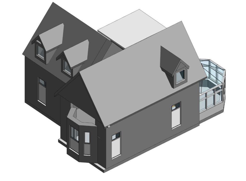
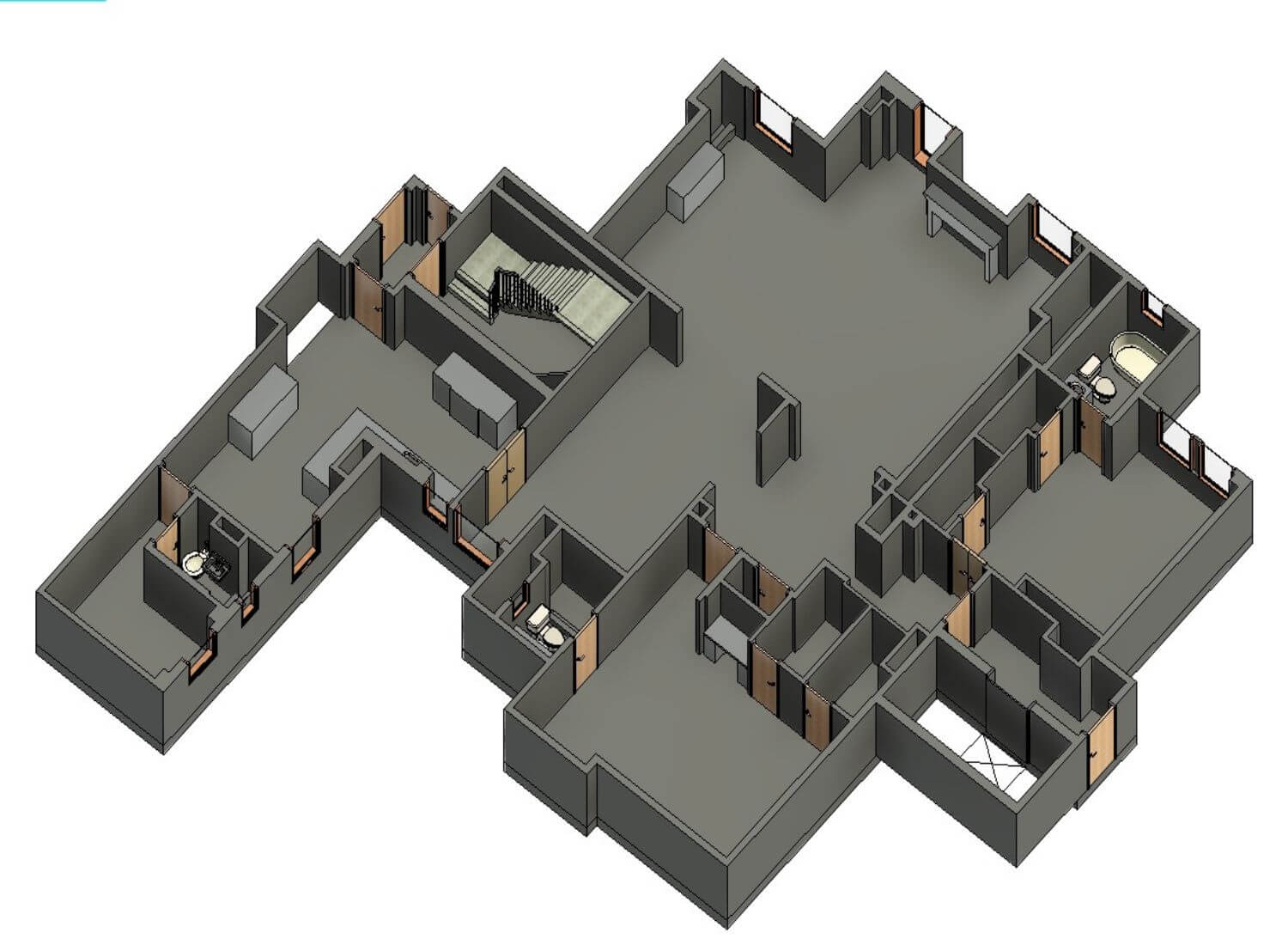
Point Cloud to BIM conversion allows decision making on a collaborative three-dimensional Revit model
Cost Effective Pricing

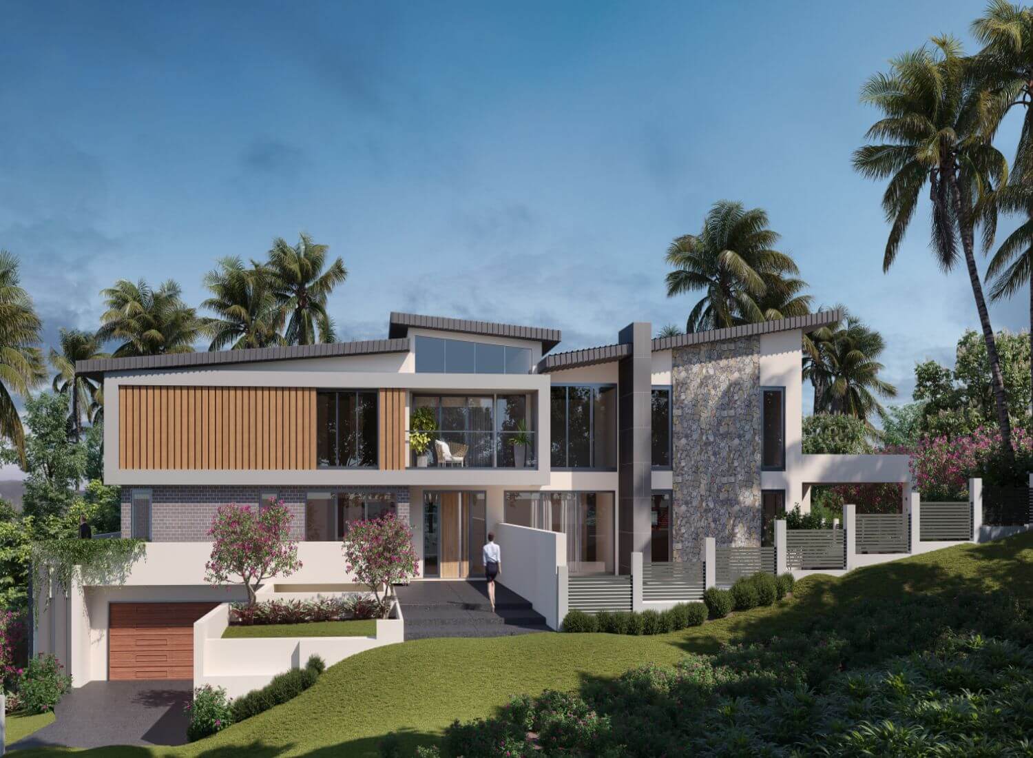
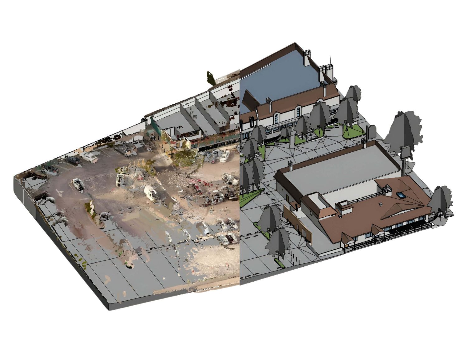
We offer considerable cost savings (up to 40%) when compared to the service costs in the USA, UK, Europe, and Australia for landscape rendering.
Eliminates Rework and Design Errors

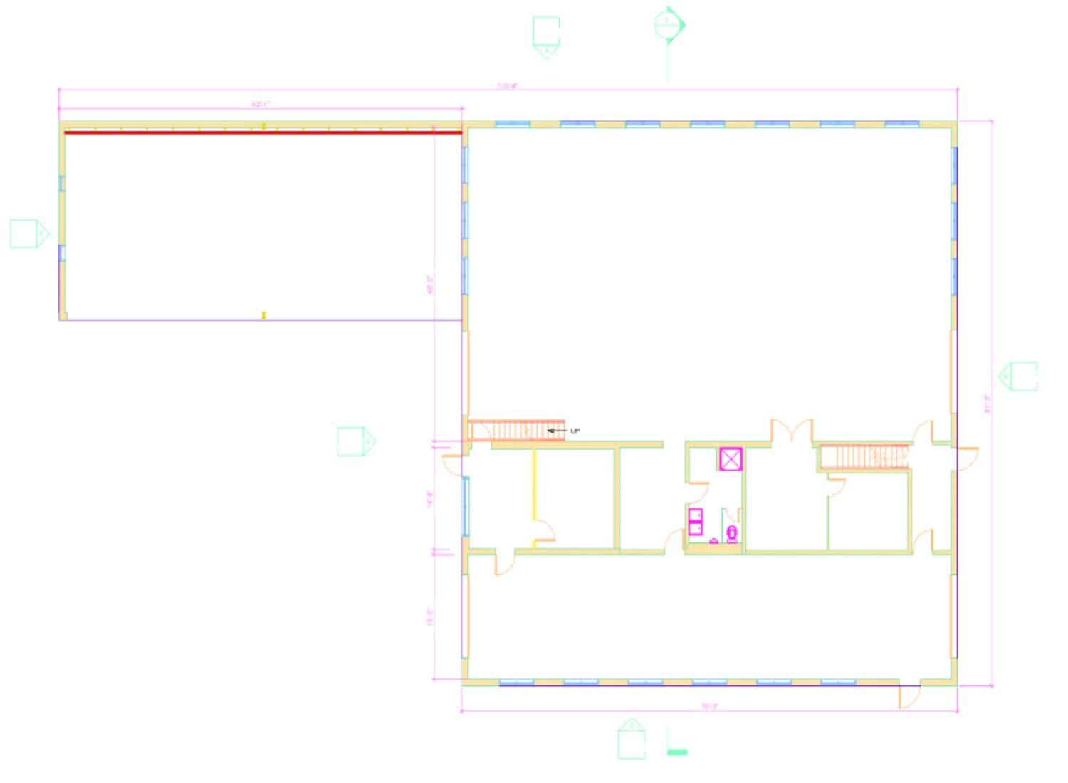
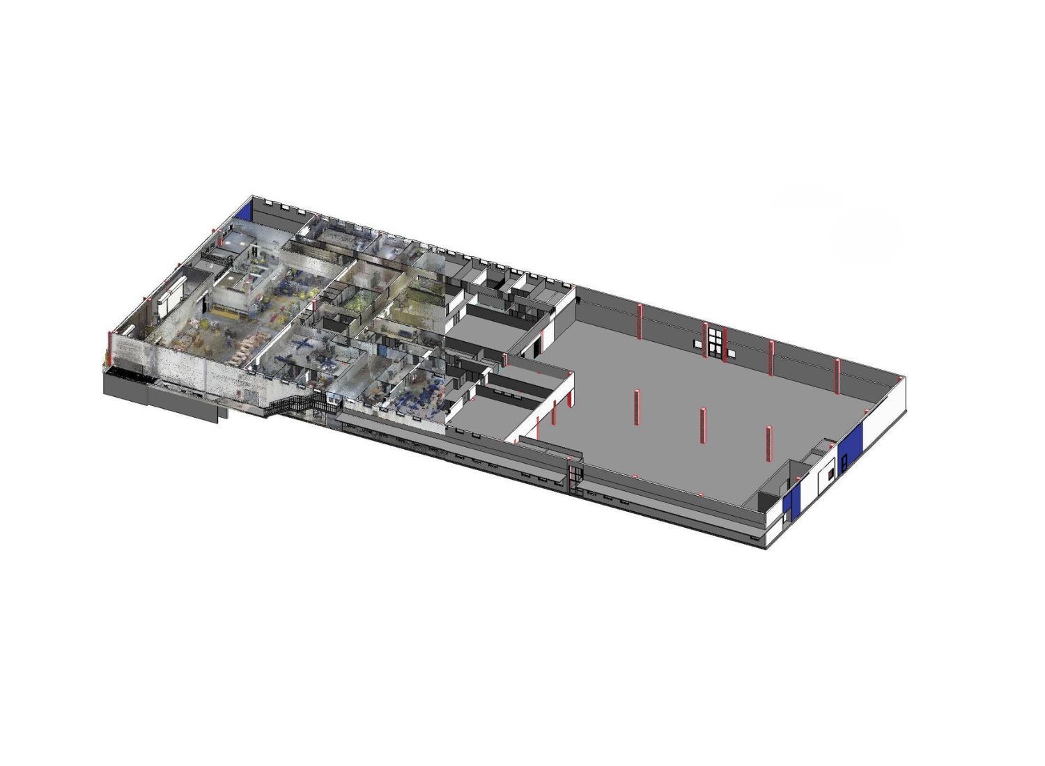
Scan to BIM Revit services reduces guesswork by capturing real world conditions and dimensions of a building
Improved Facility Management

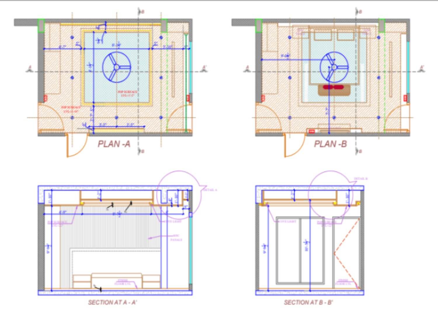
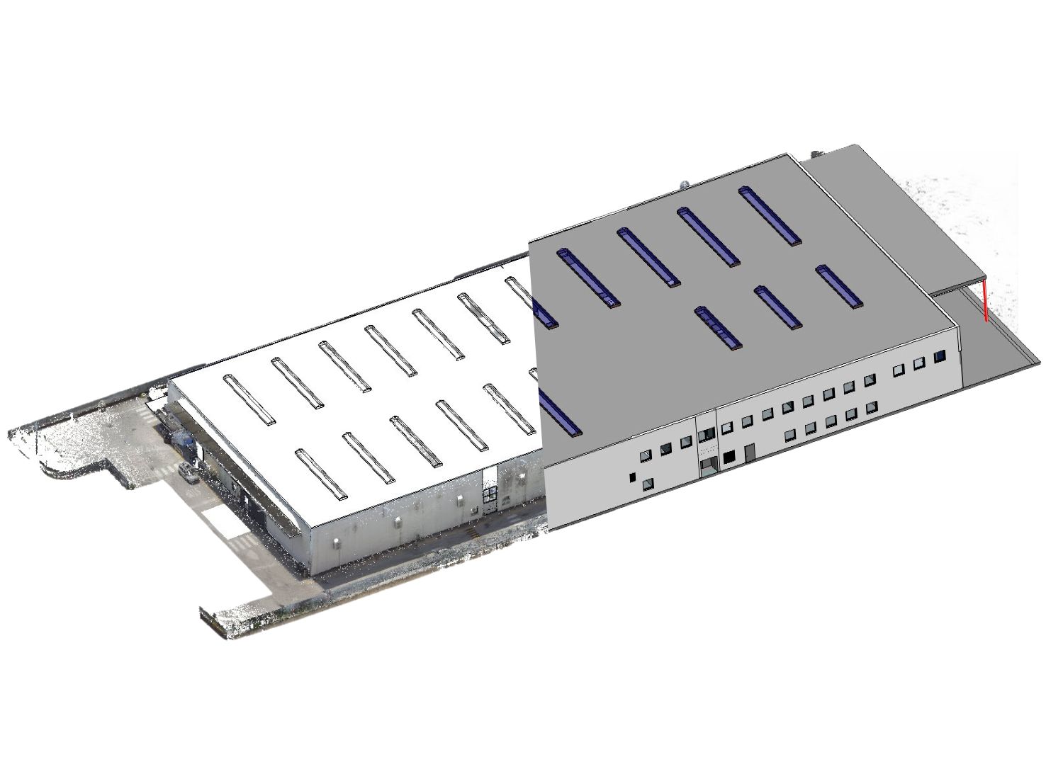
Scan to BIM models provides critical maintenance details of architectural and mep design elements in an interactive three-dimensional environment