Introduction
Topographical analysis generally evokes a very similar image in anyone’s mind – surveyors walking across lands with tapes, tripods and notebooks, measuring by hand, sketching contours and piecing together the terrain information bit by bit.
However, the field has undergone drastic evolution in the last few years. From the conventional methods, often prone to inconsistencies and lacking the level of detail required for modern civil engineering projects to embracing the new age technology of 3D laser scanning – LiDAR or drone-based photogrammetry has drastically changed the overall landscape. Now, we can have access to highly accurate and precise terrain data in much quicker time.However, this raw scanned data, no matter how precise it is, can’t help construction projects on its own
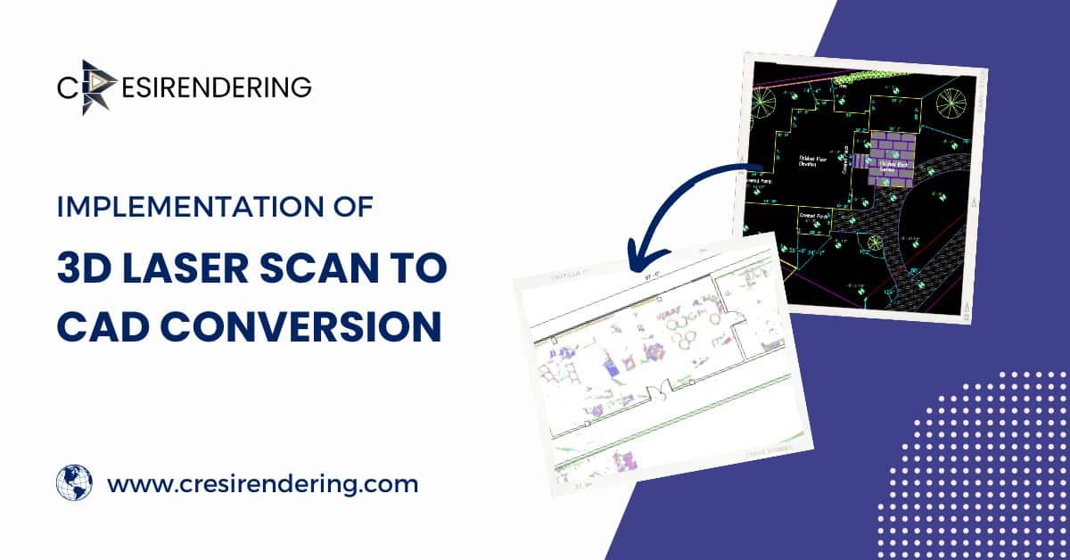
Scan to CAD conversion is the turning point, where dense unstructured point clouds data is transformed into clear and editable topographical CAD drawing sets which can be integrated in any project early on. With data on contours, drainage, soil grading and much more, Scan to CAD brings in accuracy, clarity and better usability of complex land formation in any project – helping in site planning, accurate design and risk mitigation. In short, it turns raw terrain data into information you can actually build on.

What Is Scan to CAD Conversion?
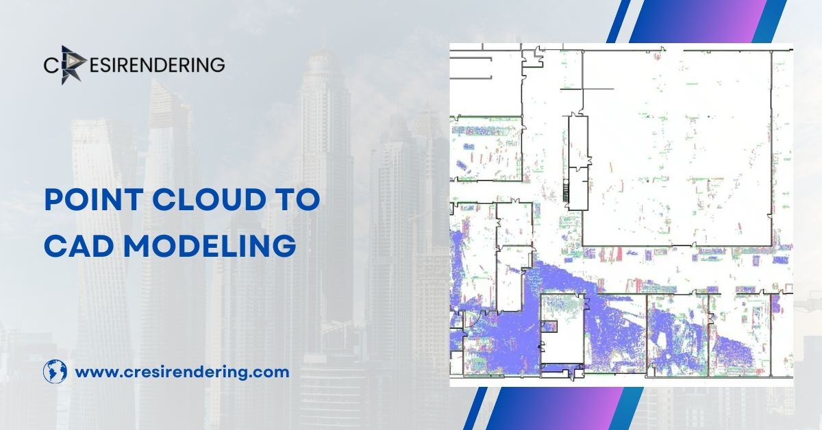
In simple and few fords, scan to CAD conversion is the main process to translate the data, as captured by 3D scanners into understandable and editable format such as DWG or DXF. The whole process begins with capturing the real world physical condition.
This can be done by any 3D scanning depending on suitability – LiDAR scanning, drone-based photogrammetry, high-resolution cameras etc. The physical site can be anything – from open empty land to uneven terrain, dense vegetation or with an existing infrastructure, everything will be captured accurately through millions of data points in a rich point cloud to CAD workflow.
This point cloud is processed meticulously through software like Autodesk ReCap, where it is aligned, cleaned, filtered and organised – all ready for interpretation. The refined data is transferred into formats that are usable and editable for further workflow. Software like AutoCAD, Civil 3D, MicroStation, or Map 3D provides professionals a platform to recreate the physical site accurately through elevation points, breaklines, contours and ground surfaces.
Further, digital contour maps, surface models, site features, drainage routes and existing infrastructure can also be mapped to give you accurate site conditions right at the initial planning stage so design is more informed to its context and any surprises or errors are minimized moving forward.These outputs also support precise site analysis CAD documentation for early decision-making.
Importance of Topographical Analysis in Civil Engineering
Topographical analysis becomes the foundation of many critical decisions in any construction project. At its core, it means studying the physical features of the land – natural and man-made. This includes everything from slopes, elevations, contours, undulations, ridges, valleys, drainage routes to even infrastructure.
These aspects of the land can highly determine the feasibility, safety and ease of any project.An accurate topographical analysis right at the initial stage of any project can support in creating a detailed site analysis of the site identifying all cut-and-fill requirements. With a detailed contour map, your design can use the natural land within its structure and create a structure that respects its context.
Identified drainage patterns will help prevent flooding and waterlogging, ensuring a longer lifespan for the structure while it remains aligned to utilities like pipelines, electrical lines, sewer systems and also land development decisions.
Any inaccuracy in this terrain data can result in design failure, sudden challenges in construction, environmental damages, increased project costs and delayed timelines.Precise data for topographical analysis, captured and converted through scan to CAD conversion has become indispensable for all AEC professionals. Every design needs to begin with a correct understanding of the site.
How Scan to CAD Conversion Transforms Topographical Analysis
1. Improved Accuracy and Detail
Scan to CAD brings an unprecedented accuracy and attention to detail that might have been impossible to capture a few years ago. Modern scanners capture the whole landform in millions of data points within dense point clouds and deliver a highly detailed and comprehensive view of the land surface.
This reduces chances of any human error and assumptions.When converted into CAD format, these point clouds become the foundation for precise contour lines, elevation profiles, breaklines and slope gradients – information essential for topographical CAD drawings and even as-built surveys.
2. Time Efficiency and Workflow Automation
A traditional survey workflow has multiple steps that can take up to days or even weeks, depending on the size and complexity of the land. Laser scanning accelerated the fieldwork while automated Scan to CAD helps in reducing the manual drafting load. The overall process enables quicker turnarounds for initial feasibility studies, site analysis CAD preparation, site evaluations and preliminary design planning. This efficiency becomes valuable in modern day large infrastructure projects where timelines are tight.
3. Enhanced Visualization and Collaboration
Topographical Scan to CAD offers an opportunity to create both – 2D and 3D visualisation capabilities. You can opt for plans with contours lines, sections with elevation profiles or even 3D models to understand overall slope and drainage more intuitively. This digital representation clarity helps teams to collaborate better, share insights and detect any design clash that might happen.
4. Better Integration with Civil Design Software
Scan to CAD does not only help in visualisation and planning but in overall workflow.You can seamlessly integrate the outputs with platforms such as AutoCAD Civil 3D, InfraWorks, Revit, ArcGIS and any other GIS systems.This flexibility ensures that you can directly import the terrain model in any software you use in your workflow and build upon it.This compatibility supports overall smoother transitions between each stage and reduces the risk of data loss.
5. Supports Sustainable and Risk-Free Planning
Topographical Scan to CAD helps you generate accurate and precise terrain data. This reduces any chance of rework and any follow-up site visits. Your team can anticipate early-on in a project any environmental risks like erosion, flooding or land deformation much and design better. Decisions you take today will support sustainable development practices in the long run. This predictive analysis will contribute to safe, resilient and environmentally responsible engineering.
Why Outsource Scan to CAD Conversion
Outsourcing Scan to CAD tasks for topographical analysis to specialised teams like us, Cresire consultant, is a smart decision with clear advantages.Our team of experts bring in their years of experiences and their expertise across multiple software platforms, ensuring high accuracy while adhering to international construction standards.
Our workflow involves multiple quality checks, organised drawings, contour refinement and detailed surface modeling that aligns with your project requirements and makes the whole process stress-free for you.
Scan to CAD, especially for topographical analysis, can be a time taking and complex process that can derail large scale complex projects in terms of cost and timelines. With global delivery capabilities, Cresire consultant can help you with large datasets, converting them quickly to manageable and editable drawings while maintaining precision and consistency.
This combination of cost and time efficiency, advanced software usage and technical expertise makes outsourcing the whole process a practical and smart choice for your project – including complex as-built surveys or terrain-heavy developments.
Conclusion
Scan to CAD has proven to be transformative for topographical analysis. It has reshaped how the survey data can support infrastructure projects today. Conversion of the scanned point cloud datasets into editable CAD drawings ensure accuracy, faster seamless workflow with better visualisation and integration with any design software.
As the AEC industry moves faster and infrastructure projects grow more complex, scan to CAD conversion helps professionals make more informed decisions rooted in precise terrain data. It no longer remains optional but a critical foundation for reliable, efficient and future-ready design.